Walloper
Lake
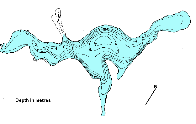
Click
on the lake icon at the right to see full bathymetric map.
Click on the moose on the left for complete BC travel information.
Location:
From Kamloops travel west on
the Trans Canada Hwy #1 for 11.4 km. (7.1 miles). Turn south onto
the Coquihalla Hwy #5. Take exit 336 off hwy 5 and drive northeast
a very short distance (1km/.6 miles). Turn south (right) and follow
this road to the boat launch, approximately 35 km. (22 miles) from
Kamloops.
Resorts
& Campsites:
There is a BC provincial day-use park located on the north side
of the lake. Facilities include a boat launch and recently constructed
pier.
BC Adventure Network members serving this area:
If you would like to have your business listed, please Click Here.
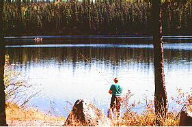
Fishing
Report: A great family lake offering a large abundence
of trout that average in the 1 lb. range with the odd one reaching
4 lbs. Walloper contains good populations of freshwater shrimp (scuds)
and leeches making it an excellent choice for the fly fishers. The
lake has an aerator to avoid winterkill of the fish stocks. Caution
should be exercised in the winter because of the danger of open
water created by the aerator.
Be
sure to visit Fishbc.com
for angling information!
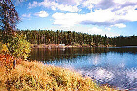
Viewscape:
Located on the Nicola Plateau, part of the inerior plateau physiographic
region, the lake lies in gentle rolling hills forested in lodgepole
pine, douglas
fir and patches of aspen with engelmann
spruce and willows in wetter sites. Patches of wild rose and
red orsier dogwood are found as undergrowth. Grasses are the main
ground cover with sedges in the moister areas.
Shoreline:
The drop-off is gradual around the shore except off the points on
the southeast side of the lake. Most of the shoreline is till and
has a well developed fringe of sedges, bulrushes and short willows.
Boulders and cobbles are common along the steep drop-offs and the
northwest shoreline. Two rocky points and a stretch of shoreline
on the northeast are free from this fringe due to a steep drop-off.
The east and west ends are flat and marshy. Many snags and wind
falls are found along the shoreline area and there is large area
of aquatic plant growth in the shallow areas and bays.
Nearby
Lakes
Surrey,
Sussex and Frogmoore lakes - Surrey, Sussex and Frogmoore
lakes are located south of Walloper on an access road south off
of the Lac le Jeune road. Elevation is around 1395 m. (4576 ft.)
and ice over is from November to mid May. Surrey and Sussex are
55 ha. (136 ac.) and 25 ha. (62 ac.) respectively. Frogmoore lakes,
a pair of lakes, total 80 ha. (198 ac.). Fishing is consistant
and fast throughout the season, for smaller trout in the 1 -2
lb. range. Surrey lake has a fishing camp with cabins and boats
while Sussex has a small BCFS campsite with cartop boat launching.
Rough camping is available at Frogmoore. 4 x 4's , may be needed
getting into Frogmoore lakes.
Note:
Always check your current BC Fishing regulations before you start
fishing a new lake.