Yellowhead
Highway:
Enjoy nature's splendor along these Highways 5 and 16, between Kamloops
and Tete Jaune Cache Junction and Hwy 16 east to Jasper or west to the
coast and the Queen Charlotte Islands (Northwest
BC). On this route,
you'll follow the North Thompson River where you can stop at places such
as Barriere and
Little Fort.
Sun
Peaks:
As BC's 2nd
largest ski area, Sun Peaks is known as a winter destination. With three
mountains and 3678 acres of skiable terrain, there is something for every
ski and board ability. In the summer, Sun Peaks transforms into a beautiful,
relaxing resort destination, with dozens of outdoor activities and weekend
events and festivals.
Sun
Peaks is located 45 minutes northeast of Kamloops. By car or bus from
Kamloops, travel north 25 km on Highway 5 to the Heffley Creek turnoff,
and then travel on the Heffley Louis Creek Road until it transitions into
the Sun Peaks Road (35 kilometres).
Clearwater:
This pleasant town was settled at the turn of the century and is well
known as the gateway to the Wells Gray Provincial Park. Clearwater is
located between Kamloops and Tete Jaune Cache on the Yellowhead Highway
(Hwy 5).
Wells
Gray Provincial Park:
This park is the third largest in British Columbia and surely one of the
most spectacular wilderness areas on the continent. It provides excellent
opportunities for canoeists,
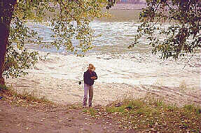
anglers, cross country
skiers and hikers.
The wildlife
habitat is abundant.
From
Clearwater drive east, passing through Blue River and Valemount
and onto Hwy 16 Junction. Continuing east, interesting stops include hiking
10 km (6 miles) into Rearguard Falls, then 3.5 km (2 miles) further to
Terry Fox Park where you may hike the Mount Terry Fox Trail. The western
entrance to Mount Robson Provincial Park lies 14 km (9 miles) east of
the Tete Juane Cache Junction.
Mount
Robson Provincial Park:
The highest peak in the Canadian Rockies, Mount Robson stands at 3954
m (12,970 feet). This stunning park offers abundant hiking opportunities
for intermediate to experienced hikers. Naturalists will enjoy the alpine
scenery and flowers
, birds,
and animals.
Also within the park boundaries are the headwaters of the Fraser River.
Camping and picnic facilities rated above average.
The following BC Adventure members would like to serve you:
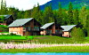
Alpine Meadows Resort: Our luxury outdoor destination is located on Hallamore Lake in BC’s spectacular North Thompson. We feature deluxe chalets & spacious log homes. Experience adventure and serenity, in a natural setting with pure air, sparkling waters and magnificent views. more
Rocky Mountain Holidays: Rail Vacations in the Rocky Mountains & Western Canada! Rocky Mountain Holidays customize vacations that combine the romance of train travel with the magnificent scenery of Western Canada. more
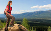
Tourism Valemount: Three majestic mountain ranges serve as inspiration and setting for 100’s of outdoor adventures in the community of Valemount. Get inspired - get out of your comfort zone - get to Valemount for a Rocky Mountain vacation where the mountains will move you. more